





AFTrack-Lite - GPS Tracking

คำอธิบายของAFTrack-Lite - GPS Tracking
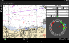
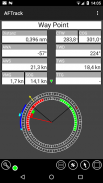
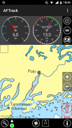
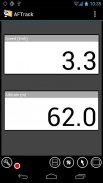
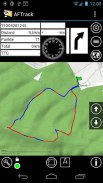
AFTrack is the display for your navigation and activates the world of hiking, biking, sailing, geocaching or more for your phone. The program handles tracking with smart and fixed logging features. If needed it sends reports online or via SMS, it receives SMS position messages and show it as a waypoint. It exports tracks and waypoints. Uses maps online and offline and more.
Features
GPS and other input
- different gps sources: internal gps, internal with NMEA, bluetooth gps direct, USB gps, online gps over Wifi/3G, NMEA file
- read NMEA, GpsD json, Signal K json
- work as gps daemon (nmea or json, port 2947 only)
- share position (replaces standard gps provider)
- connection with AIS server (NMEA format)
- altitude correction (automatic or manual) and Kalman filter
- pressure usable for altitude (if available)
- pressure start altitude editable
- automatic correction over weather server (needs net connection)
Tracking
- collect track data
- show routes or tracks in up/down hill colors
- export tracks to GPX, KML, OVL, IGC format and send or upload it
- import route data - GPX, TCX or KML format
- import, export way points - GPX or KML format
- import areas from KML format
- use a kml.txt format to send exports direct via bluetooth
- design a route or an area on the map
- design a route using BRouter offline data, with Inland waterway
- design a route using wind information and polar data
- edit a route or an area on the map
- merge some routes
- copy way points to route
- get new way point from bearing, map or position
- add predefined way point collection to map
- revers routes
- Routing in a corridor
- off road routing along the line
Maps
- online maps - pool editable, tile or WMS based
- offline maps - OSZ format build by MobileAtlasCreator
- offline maps - SQLite formats mbtiles and sqlitedb build by MobileAtlasCreator and/or Maperitive
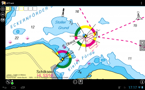
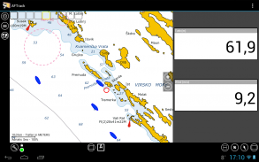
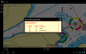
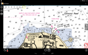
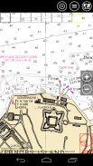
- offline maps - BSB3 format for marine navigation
- offline maps - NV digital for marine navigation
- offline maps - mapsforge vector format - with extra xml layouts usable (V4)
- offline maps - mph/mpr format
- use offline maps from jpg, png or bmp files
- use offline maps with calibration file map, gmi, kml, kal, cal, pwm, tfw or jpr format
- make own calibration for a bitmap
- seamless maps display when using OSZ or SQLite tile container
- map selector to have quick access to maps
- map scan for a defined folder and sub folder
- map overlays - online pool editable
- map offline overlays - in mbtiles 'overlay' format
- scaling charts 2x/4x
View
- wind indicator for the map or position center
- display depth - if available
- display AIS information - if available
- display ADS-B (air plane) information - if available
- vario display
- vario sound
- alarm on reached POIs
- set anchor alarm for the current position
- set anchor alarm for a way point that receives positions from a gps tracker
- save and restore settings
- send waypoint or anchor alarm to Android Wear
Online
- Online position sending for live tracking
- Online receive way point positions from a GpsGate server
- works as SMS provider (needs a plugin)
- short message position sending
- short message position receiving
- short message from GPS tracker TK102, TK102-2, TK102 clones, TK-Star, DNT, ELRO, GEODOG, Benefon ESC, Benefon Trackkeeper NT, WondeProud spt10, Tracker from tracker.fi, Wo-ist-Lilly or SmartcomGps
- text storage for short messages e.g. for Xexun tracker
- set position from short message
- send sms note to other AFTrack instance and get position back
- collect short messages to a track, single and multi-tracking
- getting way point positions from a GpsGate server
Notice: the SMS features are removed by Google.
Please send remarks to afischer@dbserv.de
The lite version differences
- no automatic position sending
- no template sending via short message
- loads only three offline maps in automatic mode
- has a start screen
- has inside advertising
- limited export
- no multi track colors
AFTrack เป็นจอแสดงผลสำหรับการนำทางของคุณและเปิดใช้งานโลกแห่งการปีนเขาขี่จักรยานล่องเรือ Geocaching หรือมากกว่าสำหรับโทรศัพท์ของคุณ โปรแกรมจัดการกับการติดตามด้วยคุณสมบัติการบันทึกอัจฉริยะและถาวร หากจำเป็นต้องส่งรายงานออนไลน์หรือผ่าน SMS จะได้รับข้อความตำแหน่ง SMS และแสดงเป็นจุดอ้างอิง มันส่งออกแทร็คและจุดอ้างอิง ใช้แผนที่ออนไลน์และออฟไลน์และอีกมากมาย
คุณสมบัติ
GPS และอินพุตอื่น ๆ
- แหล่ง gps ต่าง ๆ : gps ภายใน, ภายในมี NMEA, บลูทู ธ gps โดยตรง, USB gps, gps ออนไลน์ผ่าน Wifi / 3G, ไฟล์ NMEA
- อ่าน NMEA, GpsD json, สัญญาณ K json
- ทำงานเป็น gps daemon (nmea หรือ json, พอร์ต 2947 เท่านั้น)
- ตำแหน่งการแชร์ (แทนที่ผู้ให้บริการ gps มาตรฐาน)
- การเชื่อมต่อกับเซิร์ฟเวอร์ AIS (รูปแบบ NMEA)
- การแก้ไขระดับความสูง (อัตโนมัติหรือด้วยตนเอง) และตัวกรองคาลมาน
- ความดันที่ใช้งานได้สำหรับระดับความสูง (ถ้ามี)
- สามารถปรับระดับความดันเริ่มต้นได้
- แก้ไขอัตโนมัติผ่านเซิร์ฟเวอร์สภาพอากาศ (ต้องการการเชื่อมต่อเน็ต)
การติดตาม
- รวบรวมข้อมูลการติดตาม
- แสดงเส้นทางหรือแทร็กสีขึ้น / ลง
- ส่งออกแทร็กเป็นรูปแบบ GPX, KML, OVL, IGC และส่งหรืออัปโหลด
- นำเข้าข้อมูลเส้นทาง - รูปแบบ GPX, TCX หรือ KML
- นำเข้าจุดส่งออก - รูปแบบ GPX หรือ KML
- นำเข้าพื้นที่จากรูปแบบ KML
- ใช้รูปแบบ kml.txt เพื่อส่งการส่งออกโดยตรงผ่านบลูทู ธ
- ออกแบบเส้นทางหรือพื้นที่บนแผนที่
- ออกแบบเส้นทางโดยใช้ข้อมูลออฟไลน์ BRouter ด้วยทางน้ำในประเทศ
- ออกแบบเส้นทางโดยใช้ข้อมูลลมและข้อมูลขั้วโลก
- แก้ไขเส้นทางหรือพื้นที่บนแผนที่
- รวมบางเส้นทาง
- คัดลอกจุดชี้ทางไปยังเส้นทาง
- รับจุดทางใหม่จากแบริ่งแผนที่หรือตำแหน่ง
- เพิ่มการรวบรวมจุดชี้ทางที่กำหนดไว้ล่วงหน้าลงในแผนที่
- เส้นทางกลับ
- เส้นทางในทางเดิน
- การปิดถนนไปตามเส้นทาง
แผนที่
- แผนที่ออนไลน์ - สามารถแก้ไขพูล, ไทล์หรือ WMS ได้
- แผนที่ออฟไลน์ - รูปแบบ OSZ สร้างโดย MobileAtlasCreator
- แผนที่ออฟไลน์ - รูปแบบ SQLite mbtiles และ sqlitedb สร้างโดย MobileAtlasCreator และ / หรือ Maperitive
- แผนที่ออฟไลน์ - รูปแบบ BSB3 สำหรับการนำทางทะเล
- แผนที่ออฟไลน์ - NV ดิจิตอลสำหรับการนำทางทะเล
- แผนที่ออฟไลน์ - รูปแบบเวกเตอร์ mapsforge - พร้อมรูปแบบ xml พิเศษที่สามารถใช้งานได้ (V4)
- แผนที่ออฟไลน์ - รูปแบบ mph / mpr
- ใช้แผนที่ออฟไลน์จากไฟล์ jpg, png หรือ bmp
- ใช้แผนที่ออฟไลน์พร้อมแผนที่ไฟล์การสอบเทียบ, gmi, kml, kal, cal, pwm, รูปแบบ tfw หรือ jpr
- ทำการปรับเทียบเองสำหรับบิตแมป
- แสดงแผนที่ที่ไร้รอยต่อเมื่อใช้ OSZ หรือคอนเทนเนอร์แบบเรียงต่อกันของ SQLite
- ตัวเลือกแผนที่เพื่อให้เข้าถึงแผนที่ได้อย่างรวดเร็ว
- การสแกนแผนที่สำหรับโฟลเดอร์และโฟลเดอร์ย่อยที่กำหนด
- แผนที่ซ้อนทับ - แก้ไขพูลออนไลน์ได้
- แผนที่ซ้อนทับออฟไลน์ - ในรูปแบบ 'การซ้อนทับ' ของ mbtiles
- แผนภูมิมาตราส่วน 2x / 4x
ดู
- ตัวบ่งชี้ลมสำหรับแผนที่หรือตำแหน่งศูนย์กลาง
- แสดงความลึก - ถ้ามี
- แสดงข้อมูล AIS - ถ้ามี
- แสดงข้อมูล ADS-B (เครื่องบิน) - หากมี
- จอแสดงผล vario
- เสียง vario
- เตือนเมื่อถึง POI
- ตั้งค่าการเตือนสมอสำหรับตำแหน่งปัจจุบัน
- ตั้งปลุก Anchor สำหรับจุดทางที่ได้รับตำแหน่งจากตัวติดตามจีพีเอส
- บันทึกและเรียกคืนการตั้งค่า
- ส่ง waypoint หรือ anchor alarm ไปยัง Android Wear
ออนไลน์
- ตำแหน่งออนไลน์ที่ส่งสำหรับการติดตามสด
- ออนไลน์ได้รับตำแหน่งจุดทางจากเซิร์ฟเวอร์ GpsGate
- ทำงานเป็นผู้ให้บริการ SMS (ต้องการปลั๊กอิน)
- ส่งข้อความสั้น ๆ
- รับตำแหน่งข้อความสั้น ๆ
- ข้อความสั้น ๆ จาก GPS tracker TK102, TK102-2, TK102 clones, TK-Star, DNT, ELRO, GEODOG, Benefon ESC, Benefon Trackkeeper NT, WondeProud spt10, ตัวติดตามจาก tracker.fi, Wo-ist-Lilly หรือ SmartcomGps
- ที่เก็บข้อความสำหรับข้อความสั้น ๆ เช่น สำหรับ Xexun tracker
- กำหนดตำแหน่งจากข้อความสั้น
- ส่งข้อความ SMS ไปยังอินสแตนซ์ AFTrack อื่น ๆ และรับตำแหน่งกลับ
- รวบรวมข้อความสั้น ๆ ไปยังแทร็กเดี่ยวและหลายติดตาม
- รับตำแหน่งจุดทางจากเซิร์ฟเวอร์ GpsGate
ประกาศ: Google ส่งฟีเจอร์ SMS ออก
กรุณาส่งคำพูดไปที่ afischer@dbserv.de
ความแตกต่างของรุ่น Lite
- ไม่มีการส่งตำแหน่งอัตโนมัติ
- ไม่มีเทมเพลตที่ส่งผ่านข้อความสั้น ๆ
- โหลดแผนที่ออฟไลน์เพียงสามแผนที่ในโหมดอัตโนมัติ
- มีหน้าจอเริ่มต้น
- มีโฆษณาอยู่ภายใน
- การส่งออก จำกัด
- ไม่มีสีหลายแทร็ก


